| The host city of CEOI 2001, Zalaegerszeg | ||
 Zalaegerszeg
developed in the south-western part of Hungary, on the edge of the hilly
Zala County, on ridges rising above the former marshy valley of the River
Zala at an average height of 156 m above sea level. Owing to the terrain
configurations, it had been a small L-shaped town until the middle of the
20th century. Its highest point was in the vicinity of the parish-church.
One main street was running towards south, the other towards west, and one
side of the triangular main square was separated from the marshy fields by
the church-yard. During the 2nd half of the 19th century new streets were
constructed with bundle-wood placed in the mud every year so that
pedestrians and carriages were able to move. Zalaegerszeg
developed in the south-western part of Hungary, on the edge of the hilly
Zala County, on ridges rising above the former marshy valley of the River
Zala at an average height of 156 m above sea level. Owing to the terrain
configurations, it had been a small L-shaped town until the middle of the
20th century. Its highest point was in the vicinity of the parish-church.
One main street was running towards south, the other towards west, and one
side of the triangular main square was separated from the marshy fields by
the church-yard. During the 2nd half of the 19th century new streets were
constructed with bundle-wood placed in the mud every year so that
pedestrians and carriages were able to move.
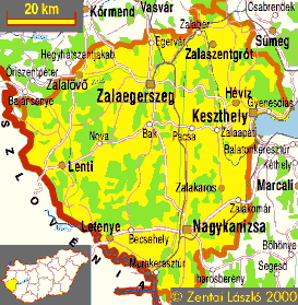
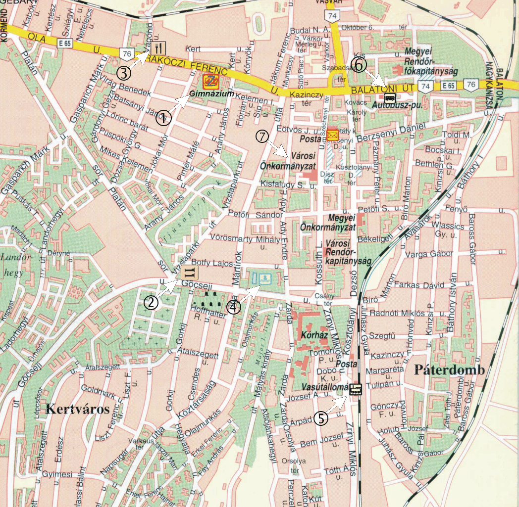
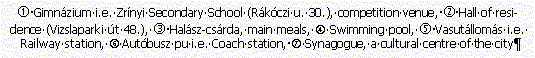
The county capital had 63130 inhabitants in 1995. The majority of the older generation was not born here, since there were some 13500 people living here half a century ago. On today's territory of the city there were only 20000 people living. The number of inhabitants increased between the 50-s and 70-s, due to immigration. Most people speak Hungarian as their native language. Only the gipsys, most of them living in the suburbs of Csácsbozsok and Pózva mainly in financially sound circumstances, have an own minority administration. The majority of people work in services or industrial plants. The number of people making a living in farming is negligible, whereas the number of civil service workers is high, due to the county capital status. The place of the competition will be the Zrínyi Miklós secondary school, in the center of the town. (Address: Zalaegerszeg, Rákóczi street 30., Tel.: +36-92-312079) The competition itself will be in the secondary school, the accomodation will be in the college buildings situated 400 m from the school.
|